A Day Trip on the Wanganui River, New Zealand
A Mysterious, somewhat Haunted Canyon
March, 2016
Click on any image for a larger view;
Contact garya at this domain if you would like the high quality image for printing
Our initial plan had been to head to
Tongariro National Park
after visiting Charlie and Maryann in Napier near Hawkes Bay.
However, the weather forecast was crappy,
so we decided to head over to the
Whanganui River
area and check it out.
I had seen a hokey movie about it on the plane on the way over.
The movie was a contrived tourist promotional,
but the area itself looked like it had potential.
As they say, getting there is half the fun.
We had a great set of maps from the
New Zealand Automobile Association
but they were over ten years old,
and it wasn't clear if the road we wanted to take went all the way through.
We asked Charlie and Maryann about the roads heading east from Napier,
and the told us the road we were interested in was indeed passable.
It wasn't all that far, as distances go...
but time is another thing...
We might have had great views of some of the volcanoes which rise above everything else on the North Island,
but the cloudy weather, drizzle and fog prevented anything of the sort.
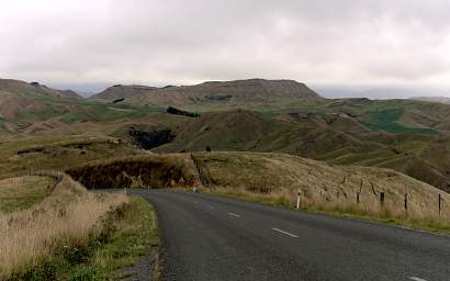
We wound up and down and over and around for hours on our way to
Pipiriki,
where we hoped to camp for the night and then take a day trip on the Whanganui River.
It was wild country,
with long distances between houses; what towns there are are few and tiny.
Along the way we saw a number of
Australian Harriers,
but we had a heck of a time getting a picture of one.
They always took off just before whoever had the camera was ready.
 |
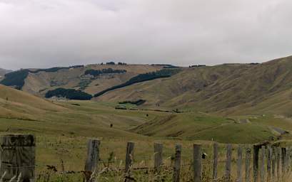 |
| Road To Pipiriki from Napier |
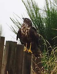 |
Australian Harrier (Circus Approximans Gouldi)
Photo by Dona |
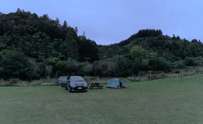
We arrived at
Pipiriki Campground
under ominous grey skies late in the day.
It was close to deserted, pleasant and comfortable.
We set up our tent and headed to the community building to cook dinner and unwind.
Then we arranged for a canoe trip the next day.
 |
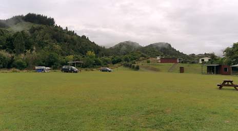 |
| Pipiriki Camp |
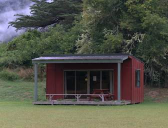 |
| Cabin you can rent at Pipiriki Camp |
The next day we hopped on one of
Whanganui River Adventure's
jet boats,
along with a number of other people and the canoe we were renting.
I had mixed feelings about doing this,
as I don't like the idea of jet boats on what is otherwise a mostly wilderness river.
Under better circumstances,
we would have driven to a town farther up river
and taken a multi-day trip down to Pipiriki.
If there hadn't been jet boat tours,
we wouldn't have been able to do what we did;
from my perspective, that would have been fine.
But there were jet boat tours,
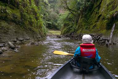
so we rented a canoe and had them take us upriver about 13 km
and drop us off for a one day float down.
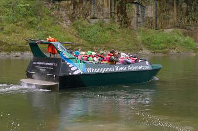 |
| Jet Boat |
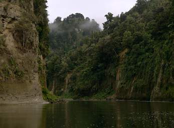
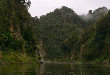
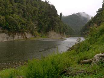
The river is wild, but not a white-water river.
There are some small rapids; nothing anyone used to running wild rivers would worry about.
But it is a cool place, and once the jet boat departed we felt as if we'd stepped back in time.
 |
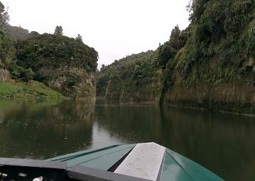 |
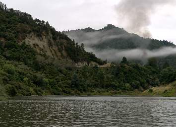
| Whanganui River |
We saw the remains of fishing platforms / weirs on the banks of the river.
There are
short-finned eel
as well as other eels and fish in the river;
they have been a staple food for the
Māori, New Zealand's indigenous people.
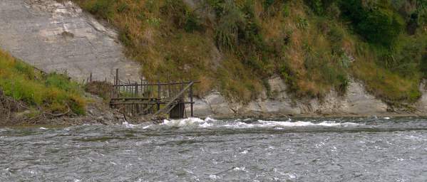 |
| Fish Trap |
 |
Fishing Platform
Photo by Dona |
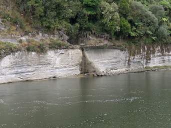
The banks of the Whanganui are steep and sparsely vegetated, if at all;
the first twenty feet or more in many places is vertical.
We were there during the southern hemisphere's summer,
and in spite of the weather, it was the dry season.
The river was in its low phase;
we had to wonder what it looked like in early spring.
How high up the banks did it get?
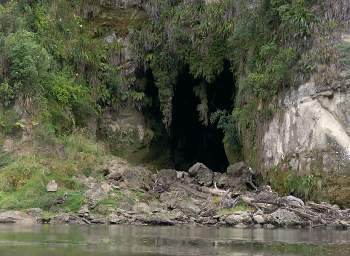
There were numerous caves in the banks,
we stopped to explore some on the way down.
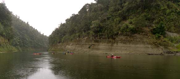 |
| Kayakers |
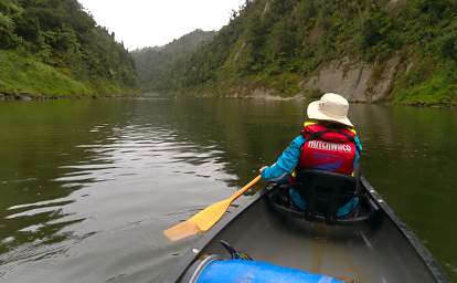 |
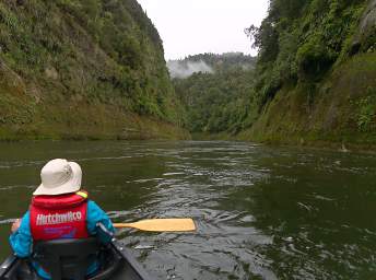 |
| Whanganui River |
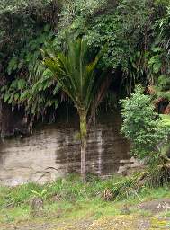 |
| Nikau Palm |
 |
 |
| |
Steep Bare Banks |
 |
| Flower Xxx Violet |
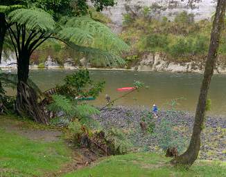
We stopped for lunch at a campsite with a picnic table and a small shelter.
We had a plastic barrel in the canoe which served as our waterproof storage;
not exactly high-tech but it worked,
although I don't know how well it would have kept things dry if we had tipped over.
While we were there a party of canoeists on a multi-day trip came down.
One of their boats had tipped over just upstream,
so they were ready for a rest and a chance to warm up.
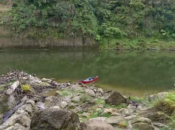 |
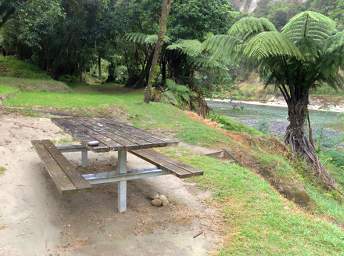 |
| Our Canoe |
Lunch Stop |
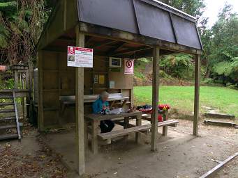 |
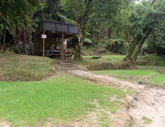 |
| Lunch Stop |
 |
| Whanganui R Dumped Canoe |
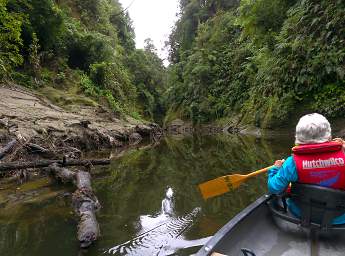
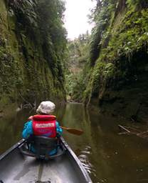
On our way up the river the boat pilot had pointed out a side-canyon
where the New Zealand movie
"River Queen"
was filmed.
Set in the 1860s, it has an interesting plot line
about a conflict between western settlers and the Māori.
Now in the canoe, we could explore a little ways up the canyon.
 |
 |
| Side Canyon |
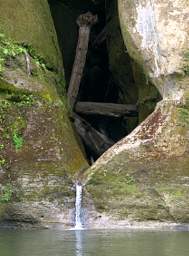
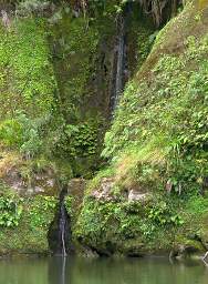
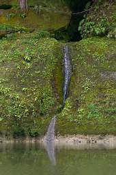
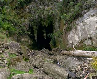
We stopped to explore one of the larger caves wehre a small stream emerged.
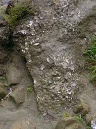
In the debris at the mouth of the cave we found rocks with lots of shells embedded in them.
We found a cool blue butterfly handing around as well.
 |
| Canoe |
 |
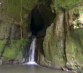 |
| Cave |
 |
 |
| Flower Xxx White Yellow |
Flower Xxx Violet |
 |
 |
 |
| Shells |
Lesser Grass Blue (Zizina Otis) |
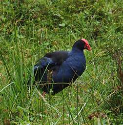
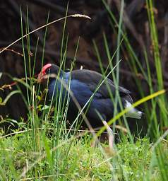
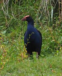
We found a lone
Pukeko
on the bank searching for insects.
It would sneak along in the grass,
all the while keeping one eye kind of cocked in our direction
and keeping a little grass between itself and us.
 |
 |
 |
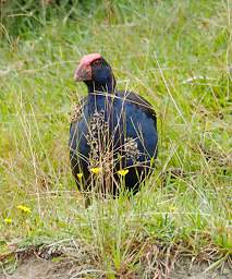 |
Pukeko (Porphyrio melanotus)
Photo by Dona |
 |
 |
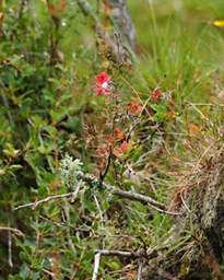
Flower Xxx Pink Orange
Photo by Dona |
 |
 |
Flower Xxx Orange
Photo by Dona |
Shrub Xxx Red Leaves
Photo by Dona |
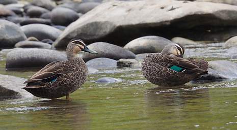
We came across some
Paradise Shelducks
and some really pretty
Grey Ducks
and Grey Duck /
Mallard
crosses.
It was interesting to look at the variation in the coloration on the
speculum.
That variation is the basis for our calling one a Grey Duck and the other a hybrid,
although as the above Grey Duck link points out,
extensive genetic testing has not been done and that distinction has not been verified as definitive.
The Mallard is an introduced species,
and its hybridization with the Grey Duck is why the Grey Duck is considered endangered,
much like the problem between
Rainbow Trout
and
Cutthroat Trout
in the western United States.
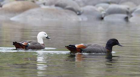 |
Paradise Shelduck (Tadorna variegata)
Photo by Dona |
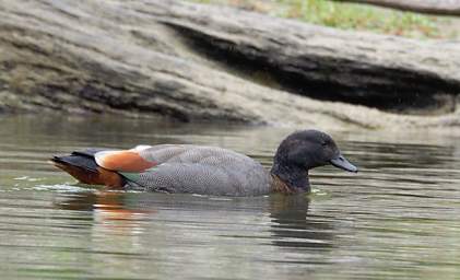 |
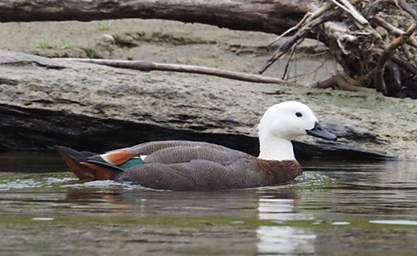 |
Paradise Shelduck (male) (Tadorna Variegata)
Photo by Dona |
Paradise Shelduck (female) (Tadorna Variegata)
Photo by Dona |
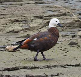 |
Paradise Shelduck (female) (Tadorna variegata)
Photo by Dona |
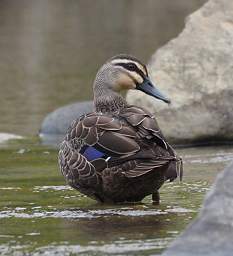 |
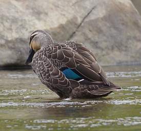 |
Hybrid Mallard / Grey Duck
Photos by Dona |
 |
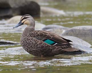 |
Grey Duck (Anas superciliosa)
Photos by Dona |
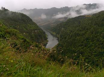
When we got back to Pipiriki
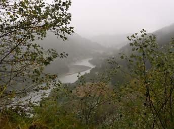
we packed up the car and headed down the road which followed the river from there to the town of
Whanganui
on the coast.
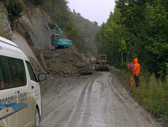
The road, known as the
Road to Pipiriki,
is somewhat notorious for being washed out all the time.
It took thirty years to finish,
and it seems like it will be in high-maintenance mode for the forseeable future.
 |
 |
| Whanganui River |
 |
| Road To Whanganui |
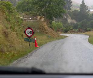
We got a kick out of New Zealand road signs.
There appear to be three speed limits in the country —
120 km/hr on the freeways; 50 km/hr in towns; and 100 km/hr everywhere else,
regardless of whether it is safe or not.
We commonly came upon signs saying "100 km/hr" immediately before a blind curve
or a right-angle bend.
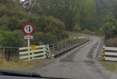
Most of the bridges of less-traveled roads were one lane,
with a sign indicating who had the right-of-way.
It seemed to work out fine,
although one does wonder how much of an economy it actually was.
There would be more material required for a two-land bridge for sure,
but the basic engineering and build process would be about the same
as for a one-lane one.
 |
 |
| 100kph Sign |
One Lane Bridge |
We got to the town of Whanganui late in the day,
but continued through town and headed west
as we wanted to see the
Teranaki Volcano,
otherwise known as Mt. Egmont.
We were looking for a place to camp or an inexpensive B&B type place.
As we were driving along I saw a sign that said something like
"explore off the beaten track, visit Bushy Park."
I had no idea what Bushy Park was,
but decided to head up that way anyway.
We're glad we did.


