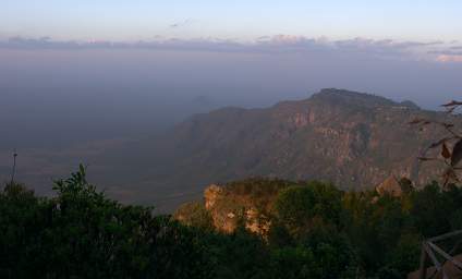
My original plan was to go up to Mambo View Point via the "back road". This is, apparently, a steep, poorly maintained 4WD road that is supposed to be pretty impressive / spectacular. I've not seen any photos of it or taken from it, so I'm not sure what that means. "Impressive" and "spectacular" are always relative to the speaker's frame of reference. However, when I mentioned this to Douglas he said he had been up it once, and that it indeed was worth doing -- if it wasn't in the rainy season and you had a good 4WD vehicle. Well, it wasn't really the rainy season, although it had rained recently; and we had a 4WD vehicle, but I wouldn't exactly call it a good one. In any case, the maps we had for planning in Montana didn't correcpond too well with reality in Tanzania, and our route and timing meant we didn't get to Mambo View Point by going up that road.
So once we got to Mambo View Point, I started thinking about going down that road. I inquired of the "people who should know" at the lodge what kind of shape the road was in. They said it was passable, and that a guy had come up it the day before. When I enquired a bit later I was told it had taken them six hours to fix the road in one spot so they could cross it, but they made it up ok. The next time the story was that a guy had to drive down from the top to meet them and bring them back up. And I think the final story was that they had walked up the last bit.
In any case, I decided our time was too short for that kind of exploration, since we really wanted to explore Mkomazi park; and I didn't want to push our rental Rav4 into that kind of terrain. So we backtracked for ten miles or so, then took the left fork (which was the right fork on the way up, and was the wrong fork when we took it on the way up...) and worked our way down the north side of the mountains and onto the plains between the Usambara Mountains and Mkomazi National Park.
 |
| The "back road" goes down the other side of the far ridge. |
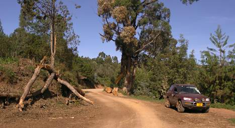
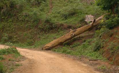
As it was, even the relatively good road we did take had only recently had a number of big trees which had fallen over it cut out. The road is very picturesque, in many places lined with trees on the downhill side. It has wonderful views, and would be a superb bicycle touring route.
 |
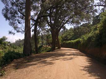 |
| Trees Recently Removed from Road | Usambara Mountains Road |
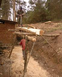
Along the way we got a real treat. I have read about pit saws and understand intellectually how they work, but had never actually seen one. We came around a corner and there were two guys sawing away. I slammed on the brakes and asked them if I could watch and take a photo. I was impressed by the relative speed with which they were able to cut out a plank. The planks they had sawn were remarkably consistent. It is not an easy job. I don't know which is harder to take; the man in the pit has all the sawdust raining down on him, but the one on top has to pull the saw up with each stroke.
 |
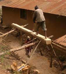 |
| Pit Saw | |
The road went down, and down, and down. We crossed over a ridge and looked out to the plains, and could see our road with all its turns and switchbacks weaving its way down.
 |
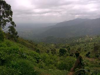 |
| Tree Recently Removed from Rd | Road Down to the Plains |
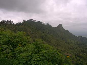
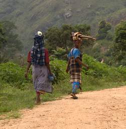
There were houses perched on the ridge, and we passed people walking from there down to the town or fields far below for work or to shop. The road was well rutted in places, particularly where recent heavy rains had concentrated in ravines and washed over it.
 |
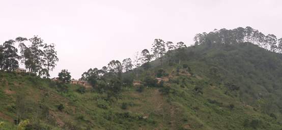 |
| Ridge | Houses Perched on Ridge |
 |
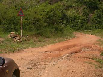 |
| Women heading to work | Bad Road |
We were still winding around the mountains, and the gas gauge was inching its way towards empty. We stopped in the small village of Mlalo and inquired about a place to purchase fuel. The person we asked mentioned a name and pointed around the corner back the way we'd come. We turned around and drove back, then inquired of some young guys sitting on the front porch of a small building. They indicated they were the place to buy fuel, so in my pidgin-Swahili I said we needed ten liters. They brought out the first liter in a plastic pepsi bottle, then cut up another one to make a funnel, and poured it in one pop-bottle at a time. Virtually every vehicle on the road here is a motorbike, and a liter goes a long ways in one of those.
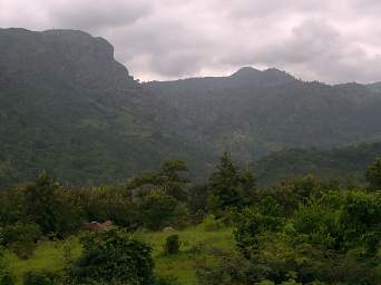 |
| Usambara Mountains |
We stopped in the middle of the road when a Blue Agama Lizard ran across. When we went to start up again, the engine wouldn't turn over. It took a few minutes to figure out the problem -- all the bumpy roads had loosened the battery cables -- and then we were on our way.
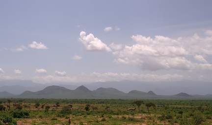
And then, bingo! One minute we were heading down, down, down; and the next we were on a pancake-flat plain, amid large fields; the road was built up as if on a dike. For 180 degrees we saw mountains, and for the other 180 degrees there was nothing but flat as a pancake fields. We knew there were supposed to be mountains in the distance in Mkomazi National Park, but we couldn't see them.
 |
| Usambara Mountains from the Plains |
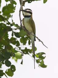
We didn't get too far down the road before we skidded to a halt, There were brightly colored birds all over.
 |
 |
| African Golden Weaver | |
 |
 |
 |
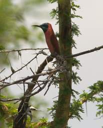 |
| White Throated Bee Eater | Northern Carmine and
White Throated Bee Eaters |
Northern Carmine Bee Eater | |
The land was flat. Really flat. Really really flat. It was unclear where all the water that came down from the mountains when the rains came would go. Periodically we would come across what would be a normal crossing with a culvert under the road here in the United States, but it was pretty bizarre. The culvert was always up above the level of the road, because if it was down lower so the road could go over it smoothly it would be buried in the sand and clay and mud. If the culvert was at the lowest height it could be at and still pass water, then the road would be under water at that point. I guess that is what happens. Which is why you need a snorkel on your car, and why you probably want a diesel engine.
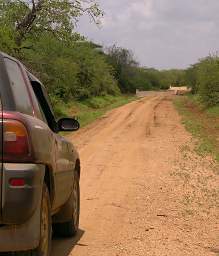 |
| Culvert Humps in the Road |
Our plan was to head northeast and enter Mkomazi National Park at one of the southern gates, but once again the roads on the maps and the roads on the ground did not really match up. We stopped and asked directions of several people, and got several different opinions, usually in direct opposition to each other. We decided to just work our way north. and eventually we looked up and could see Mambo View Point. We found the start of the 4WD back road up to Mambo View Point; I still think it would be a good road to take some day, and maybe some day I will have another opportunity. We were at the north end of the Usambara Mountains, and wanted to get to one of the Mkomazi National Park gates and a campground for the night. The map indicated a way to cut across the plain to connect with the main road going north. We found "the road" and headed off in the direction we knew was right. The road steadily deteriorated along a seasonal riverbed, then turned into a cow path. We encountered a couple of herders who informed us that the "road" didn't go through, so we backtracked. Maybe we should have continued on, working our way across the plain until we hit the road we knew to be on the other side. But we didn't. Our vehicle was a Rav4 with a decent paint job, not a Land Rover, and every bush in sight, of which there were many, was covered in thorns.
My diary says "Lost in Africa is great if you have lots of gas, lots of time, and some sense of the topography."
 |
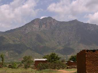 |
| Usambara Mts. from the Plains | Mambo View Point |
It was getting late and we decided we didn't have time to make it all the way to Mkomazi, so we headed over to the town of Same for the night. We spent the night in the campground at the Elephant Motel, which worked out ok but not great. The good news is it was reasonable, $10/each for the night. The bad news is it is right on the highway and there is plenty of road noise and lights at night. When we went to take a shower the knob came off and squirted water all over, but we got that under control and actually got a warm shower. There were the all-too-frequent calls to prayers, blasted over a loudspeaker; a poor substitute for the birds, crickets and frogs we were used to. We got up early the next morning and headed to the park.