 |
The weather had been exceptionally nice, the larches were approaching their peak color, and I wanted to see some new back country. So I threw together some food, measured out feed for the horses, and took off.
It's something of a ritual to ride out from home, cross the river, and be off. The river is some kind of psychological boundary; crossing it going out marks the start of an adventure, and it is a welcoming act coming home.
It was sunny and warm, and remembering an email sent by Martha Evans, Amber's wonderful mom, I started to whistle. Or tried to. Her email had remarked how one seldom hears people whistling on their way to work anymore. It's a sad comment on our busy-ness as a society.
But... Egad! I couldn't whistle any more. At least not a proper tune. Like others, I hadn't whistled much for years. I remember way back when, I could whistle ok. But I wanted to be able to whistle really loud. So I learned to do that, with my tongue all bent around weird. But now I couldn't whistle a tune. I wet my lips. No change. It was a warm day, so I couldn't blame the cold. So this has been the trip of re-learning to whistle.
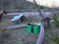
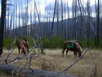
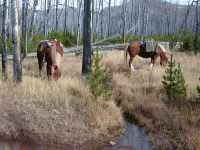
We made good time up to the trailhead, and then up to the Dry Fork Cutoff, where we camped. There was plenty of grass for the horses, although it was dried out. They enjoyed their extra ration of grain.
 |
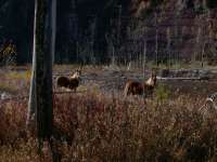 |
| Dry Fork Cutoff Camp | Poppie and Daiquiri |
One of the problems with horse packing alone is figuring out how to get the panniers on and off. Besides being heavy, there is the problem of only putting one side on at a time, and leaving the first pannier on the horse, horribly unbalanced, while you get the other one and put it on. With two people, one person can support the first pannier until the other person gets the second one on the horse. When loading up in the morning, it isn't too bad for one person if the panniers aren't too heavy, as the cinch on the pack saddle is generally tight enough to keep things from slipping. But after a day's worth of exercise, the cinch has usually loosened up a bit. When you take the first pannier off, the other one will roll the pack saddle around and under the horse's belly, and then you'll have some... fun.
My solution to this problem is to use two boating straps, and effectively tie off the saddle tree to the horse's leg on the side opposite the one where the first pannier is loaded. After the second one is loaded, the strap going down around the horse's leg is removed. It works pretty well. In the picture below, the pannier you see is the one which would come off first. The strap keeps the pannier on the other side from pulling the pack saddle down.
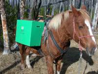 |
| One Person Unpacker Straps |
I decided to alternate horses, switching the one I was riding and the one I was packing each day. So on the second day I packed up Poppie, saddled Daiquiri, and off we went. Poppie is always a little more lively than Daiquiri, and she sure was eager as we rode the mile or so up to the North Fork Cabin. When we got there I tightened everything up, and we headed up trail behind the cabin and around the falls. Everybody was doing great, going calmly along.
We were just passing the falls when Poppie suddenly got really antsy. Before I could do anything she crowded up past me, knocking Daiquiri partly off the trail. I bailed off Daiquiri, fearing she would loose her footing and roll, and tried to stop Poppie as she went by. This was a good example of why you don't tie the lead rope to the saddle horn... we'd have had a real mess with me tied up in the middle. By the time I hit the ground Poppie was headed down the steep hillside and I couldn't turn her; she tore the lead rope out of my hand and bolted downwards. My heart sank as she crashed down the slope towards the cliff that fell away to the river and the falls below. I thought I had just lost a good horse. I couldn't see what set her off, as the panniers were still staying put. After about a hundred feet she slowly turned, but kept angling downwards as she headed back the way we had come. Sooner or later she would be at the cliff. For an idea of what the terrain a few hundred feet downslope of us is like, For an idea of what the terrain a few hundred feet downslope of us is like, here are some pictures of the area around the falls. more pictures
Maybe it's instinct, maybe self-preservation; maybe she saw the cliff and it scared her more than whatever was bothering her. Whatever the case, she finally angled upwards and back to the trail, where she barreled off back down.
All this happened in less than a minute. Daiquiri was ok, but nervous with all the hull-a-baloo. I hopped on and headed back down the trail as fast as we could walk, figuring any faster would just spook Poppie more. I continually called in what I thought was a calm voice to a now-unseen Poppie.
I found her in a small ravine, a hundred feet or so from the cliff, sweaty and shaking. The panniers and manty rope were on the ground; the pack saddle under her belly. I managed to calm her, release the panniers, free the manty rope, slide the pack saddle back where it belonged, and walk her over to a small tree where I could tie her. She wasn't badly cut up, and other that scared to death seemed to be ok. The manty tarp wasn't even torn.
I left the horses tied up and figured they could just stand there and calm down a bit. The only things I'd had outside the panniers were my sleeping bag, my fly rod case, and a small camera tripod. I figured they had rolled down the slope into the river, but backtracked as best I could to check. Much to my surprise, I found all of them about 100 feet downhill from where Poppie had left the trail.
I finally decided my rod case must have inched backwards out of the manty tarp and poked Poppie in the hip. When it poked, she jumped, which caused it to poke her again...
If every day is an opportunity to learn something new, then this day certainly wasn't wasted. The panniers didn't seem too badly beat up, although one of the screws to the lid on one of them was ripped out. I imagined the coleman lantern was probably broken inside, but there didn't seem any point in checking. For once, I wasn't packing any eggs... When we finally reached camp and I checked, the lantern was just fine, although the mantle needed replacing.
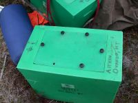 |
| Damaged Pannier |
Deciding discretion is the better part of valor, I unsaddled Daiquiri and switched back to riding Poppie and packing Daiquiri. I put the rod case behind my saddle, and tied the tripod so it couldn't possibly slip backwards. I'm still not certain the rod case was the problem, but I can't come up with any better answer.
We headed back up the trail. Poppie was a bit nervous but did ok.
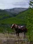 |
| Poppie above the Confluence
Note saw in scabbard |
We crossed the North Fork and headed up the East Fork. This is all country burned in the 1988 Canyon Creek fire. It was mostly lodgepole pine and what is called a stand-replacing fire, meaning instead of a spotty burn pattern, everything in the stand burned. The new lodgepole were coming along nicely, but were still short enough you could see over them in most places.
We rode past the back side of Mineral Hill and Windy Pass. Next year I hope to cut out that trail so we can make a loop up Windy Pass and down the North Fork. The trail is blocked by lots of downed timber from the burn.
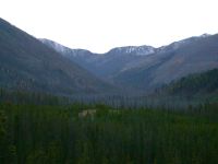 |
| Back Side of Windy Pass |
A little farther along we passed the trail off to Meadow Creek, then took a lunch break where Lost Pony Creek crosses the trail.
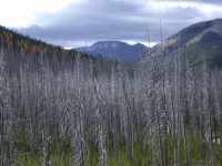 |
 |
 |
| Meadow Creek Drainage | Lunch Stop | Lost Pony Creek |
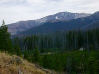
As we continued on, Red Mountain came to dominate the view. Amber and I had ridden most of the way to the top of it some years ago, then tied the horses and continued on to the top on foot. Despite the warm weather, the north slopes on back side of it still had snow from several weeks ago.
 |
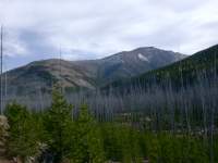 |
| Red Mountain |
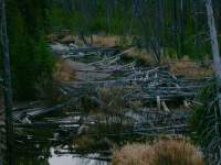
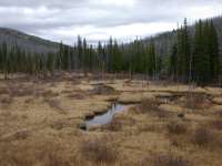
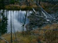
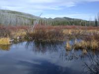
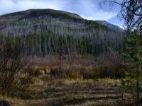
As we continued on, the river became less of a stream and more of a jumble of dead snag piles amid beaver ponds. We made camp in the burn near Sourdough Creek.
 |
 |
| Log Jams | East Fork Blackfoot |
 |
 |
 |
| Beaver Dam | Beaver Ponds | From Sourdough Creek Camp |
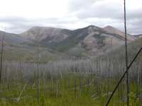
The next day we passed Parker Lake and headed over the hump to the Landers Fork. The whole Landers Fork drainage seemed more completely burned than the East Fork and the North Fork. We were constantly riding in wobbly, unstable, ready to crash down burned timber.
 |
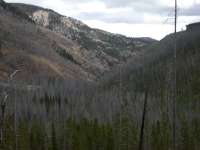 |
| Landers Fork Country |
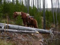
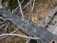
Despite being relatively well maintained, the trail had numerous trees across it. I spent a lot of time hopping off Poppie, pulling out my saw, and cutting out trees.
For this job I have a new saw, a 24" pruning saw. It fits nicely in a saddle scabbard, and is a joy to use. I find it cuts faster than a big crosscut saw, and is a heck of a lot handier. But it's not quite as big, so if a 36" tree comes down, I hope I can saw a way around it...
 |
 |
| Downed Tree | Trusty Pack Saw |
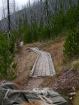
In spite of the dry year and it being the end of a dry summer and fall, the side creeks were still running and there were numerous boggy spots. To cross the spongy areas, the forest service has done a great job of laying pieces of corduroy road.
 |
| Corduroy Boardwalk |
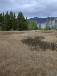
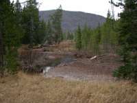
Our destination was Middle Fork Creek. We made it there just after noon.
 |
 |
| Middle Fork Creek |
Because it was early, and because I was concerned about all the downed timber, I decided to see if we could make it up the pass and over the top. This would give me a layover day to explore more. I didn't think the trail over the pass had been used much, and I wanted to see if it was passable or not.
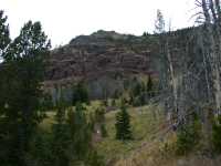
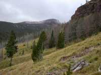
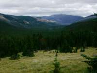
The trail seemed well used, and was a delight as it wound up the valley, through small meadows. Unfortunately, the creek was dry in most places down low where there were nice meadows. As we got higher, the trail became less well defined, and eventually disappeared when we reached the alpine meadows under the cliffs. I got my exercise scrounging up and down and around looking for it, but couldn't find it. If I'd been back-packing, I could have just gone up and over, but with the horses it wasn't so easy. On my way home I stopped at a neighbor's place and he told me there was a trail down the other side, but he'd want three days and a good saw to cut it out...
 |
 |
 |
| Alpine Meadows | Middle Fork Creek Drainage |
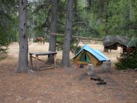
So we headed back down and made camp in the nice meadows by Middle Fork Creek. There is an outfitter camp here, although it didn't look much used recently. I was disappointed in the garbage left around, and the way they had left their poles lying on the ground all over with long spikes sticking up through them. The horses enjoyed the grass while I packed up the garbage to haul out.
 |
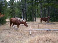 |
| Middle Fork Creek |
I was hoping it would clear up by morning. If so, I planned to try an alternate route up the north ridge of the valley. This would take me to the summit of Crow Peak, from where the trail supposedly went down another ridge and then headed off down Cooney Creek to Carmaichel Cabin.
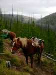 |
| Crow Peak Ridge |
Unfortunately, the weather Gods weren't with me. It blew all night, spitting a little rain now and then. You could hear an occasional tree crashing down. I was thankful to be in a somewhat sheltered area with live trees. Poppie slipped her halter during the night, but didn't wander off. I woke up after midnight and realized I was only hearing Daiquiri's bell, and she was acting a little fidgety. I discovered Poppie was missing, but found her nearby and tied her back up, tightening her halter a notch.
The next morning the clouds were lowering around the top of Crow, and I decided since I wasn't familiar with the trail, and it didn't look well used, I probably didn't want to try to cut my way through a lot of blowdown in a marginal visability situation. So we turned around and headed out.
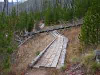
Holy Moley! That turned out to be the right choice. In one night, more timber had blown down than I had cut out the day before. It was a little nerve-wracking going down the trail with the wind still gusting and trees toppling occasionally. The horses were a bit jittery, but did ok.
 |
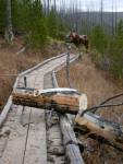 |
| Downed Tree | Saws are good... |
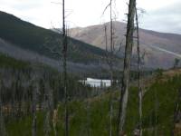
The horses knew we had turned around, although they probably didn't realize we weren't going straight home. They were eager as we headed back down the trail. Despite the clouds, we had great views of the surrounding country.
 |
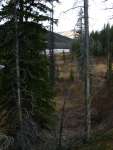 |
| Parker Lake |
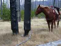
We took lunch at Lost Pony Creek again, where I noticed it might not be the best spot with the wind blowing...
 |
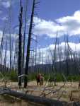 |
| Tree Waiting to Fall |
We camped on a small peninsula near where the East Fork joins the North Fork. The horses had good grass, and I went fishing.
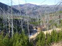 |
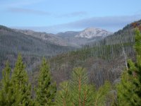 |
| North Fork above Confluence | Looking Up the Dry Fork |
The next day I packed up and we headed home. We passed the falls, with neither horse being too nervous.
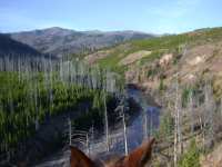 |
| Above the Falls |
As we wound down the hill towards the cabin,
I noticed an old snag with a certifiable "Indian Compass."
If you don't know what an indian compass is,
read
 |
| Indian Compass |
Then it was down the trail to home. And as I rode, I whistled. Not perfect, but certainly better than on the way up.
 |
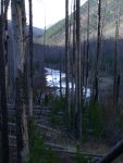 |
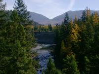 |
| Approaching North Fork Trailhead | North Fork | North Fork above HawksNest |
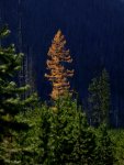 |
| Larch |