 |
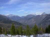
The days are shortening up way too quickly, the snow's flying, and it looks like what snow has fallen in the high country is there for the winter. I decided if I was going to enjoy any more all day rides, I'd better do it in a hurry. Earlier in the summer, Lynde and I had ridden to the top of Ovando Mountain . On that, and other occasions, I'd seen a road that cut through the forest and came higher and closer than the approach I've always used to get to the top. A few weeks earlier, Lynde and I had ridden up to the trail that cuts from the logging roads on my side of the mountain over to the logging roads on the forest service side, in the Lake Creek drainage. At that point I had finally figured out where that road came from. I decided to go up and have a look.
When I got up there was fog everywhere, so I figured it was going to be a nice day. I brought the horses in and fed them, then went inside to eat breakfast. I bundled up, stuffed a few things in my pommel bag for a snack, filled my water bottle, and saddled up Poppie.
In spite of the fog promising a sunny day, there were mares tales coming in from the west, and a cloud bank pushing over the divide from the east.
Hunting season for the low country opened up last weekend, so I had my blaze orange camoflage sweater (how's that for an oxy-moron? But it's true...) on over my fleece vest, with my duster behind the saddle in case things got ugly.
Poppie was a bit reluctant to head out at first, but then she warmed up. We crossed the river, then trotted a few miles to where the trail heads up. There was still snow on the ground from last weekend, although not much. Four to six inches in the shade. It was nice to look at the animal tracks as I rode along.
As we climbed up, I looked back to see Kleinschmidt Flat tucked in at the base of the mountains. When you get up high, it's pretty obvious why it's named Kleinschmidt Flat. It looks flat no matter where you are.
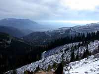 |
| Looking SE Down to Kleinschmidt Flat |
Looking ahead, you could see up the North Fork of the Blackfoot, what I like to think of as my river, since it flows by the house. The day wasn't particularly clear, but you could still see to the continental divide. My house is about 4200 feet elevation, and while the mountains here are not particularly high, there is enough relief that they stick out. Lake Mountain is the big one on the left, about 8000 feet. To its right, just sticking out, is Flint Mountain, which is on the continental divide. It is a three way divide, with the Blackfoot running southwest, to the Clark Fork, Pend Oreille, and Columbia; the Danaher flowing north to the South Fork of the Flathead, Kootenai, Clark Fork and on; and the Sun flowing northeast to the Missouri.
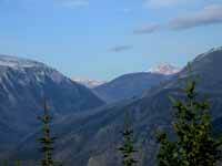
In the photo below with Mineral Hill on the right, Windy Pass is the low spot to the right of Mineral Hill.
In the photo below, there is a big hillside in front of Evans Peak. The North Fork Cabin is right at its base, where the Dry Fork and the North Fork of the Blackfoot join. North Fork Falls is up the canyon to the right, on the North Fork.
 |
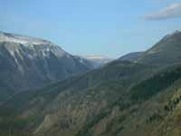 |
| Looking Up the
North Fork of the Blackfoot to Flint Mt. and Evans Peak |
Flint Mountain on the
Continental Divide |
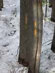
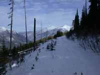
If you go far enough, eventually you come to the end of the road :-). But just before you get there, you can cut off through the trees on a trail marked with blazes. After about a quarter mile, you come to another road. The first set of roads, the ones behind my house, are logging roads built by Champion International Timber Co.; the set you connect to are U.S. Forest Service logging roads. I continued on up the new set of roads, and eventually came to a pass or sorts. From there it is all downhill into the Lake Creek drainage, and down to the trailhead at the end of the North Fork Road.
 |
 |
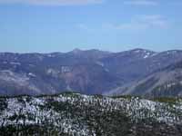 |
| Blazed Trees | View on the Other Side | Lake Creek Drainage |
I'd been over this pass before, and down to the trailhead, then back down the road and through the neighboring ranches to get home. But it is a pretty long ride, and the day was short. Besides, I had passed up the fork that goes off towards Ovando Mountain, and I wanted to see just exactly where it went.
Because of the high wispy clouds and the lowish sun, I wasn't getting particularly warm on this ride. Poppie was doing ok, since she was moving. But my feet were getting cold in spite of my woold socks, partly from not moving much, and partly from the steel toes in my boots. I started doing a gentle tap dance, one foot and then the other, to try to warm them up a little.
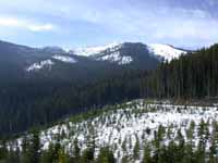
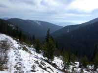
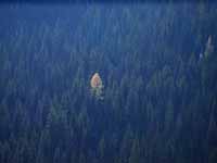
I rode up the other fork in the road, and there was Ovando Mountain. The road winds up one side of Spring Creek, a small creek which runs into the North Fork more or less opposite my house. You can't ride too far up the creek from the bottom, because the road ends in the middle of some thick timber, and the timber continues all the way up. Most of it is Douglas Fir, Grand Fir, and Spruce, but there are occasional Larches, particularly pretty this time of year. The Larch is the only conifer that sheds its needles in winter. They turn a wonderful golden color, similar to Aspen and Cottonwood, but a few weeks later.
 |
 |
 |
| Ovando Mountain and
the End of the Road |
Spring Creek Drainage | Lone Larch |
I saw lots of tracks in the snow on this trip, a few nice mule deer bucks, a nice bull elk, and a couple of eagles. All in all, a great day.